
The Fryingpan Valley Near Aspen: A Complete Guide to Colorado's Quietest River Canyon
Most people who visit Aspen never turn up the Fryingpan.
They come down Highway 82, they stay in town, they ski or shop or eat, and they drive back to the airport having never learned that twenty minutes down-valley there's a turn in Basalt that leads into one of the quietest, most beautiful river canyons in Colorado. The road follows the water for 32 miles. There is no cell service. There are two towns, and calling them towns is generous. And at the end of it, the pavement gives out at the Continental Divide.
This is a guide to that valley — what's in it, when to come, and how to actually plan a trip here.
Where is the Fryingpan Valley?
The Fryingpan Valley runs east from Basalt, Colorado, about 18 miles down-valley from Aspen. Frying Pan Road (County Road 104) leaves Basalt and follows the Fryingpan River upstream for roughly 32 paved miles, past Ruedi Reservoir, through the hamlets of Meredith and Thomasville, before turning to dirt and climbing toward Hagerman Pass at 11,925 feet.
The valley sits inside the White River National Forest — 2.3 million acres of public land, the most-visited national forest in the country. Its walls are red sandstone from the Maroon Formation, rock that's roughly 250 million years old. The contrast of that red rock against blue spruce and Douglas fir is the thing people remember.
The Fryingpan River: Gold Medal Water
The Fryingpan is one of Colorado's most famous trout rivers, and the reason is a dam.
The river originates east of Aspen in the Hunter–Fryingpan Wilderness and flows northwest into Ruedi Reservoir. Below the reservoir, it travels another 14 miles before joining the Roaring Fork River at Basalt — and that entire 14-mile stretch from the dam to the confluence carries Colorado's Gold Medal designation.
What makes it special is what comes through the dam. Mysis shrimp — introduced to the reservoir decades ago as forage for kokanee — get pulled through and delivered downstream to waiting trout. The result is a protein-rich food supply that fuels remarkable growth: fish that would run 14 inches on a typical freestone river often push 20 inches here. Water temperatures stay stable year-round, roughly 38–52°F depending on season, so the trout feed actively twelve months a year. There is no true off-season on the Pan — winter often produces excellent fishing when other rivers are locked under ice.
The trade-off is that these are educated fish. They've seen every pattern, and they reject them with an indifference that has humbled a lot of accomplished anglers. Guides call this stretch trout university for a reason.
Access:
Of the 14 miles between the dam and Basalt, roughly 8.5 miles are public access — a mix of Forest Service land, state land, and Division of Wildlife easements. Figuring out exactly where the access is isn't always easy; some is signed, some adjacent land is posted no-trespassing. A local fishing map is worth buying before you go.
Where the crowds are: the tailwater immediately below the dam — a hole known as the Toilet Bowl — holds the biggest fish and, accordingly, the most anglers. Be prepared to stand in line. If you want quiet water, the upper Fryingpan above the reservoir offers pocket water and far fewer people.
Seasons on the river:
Winter (Dec–Mar): low flows, technical midge fishing, almost nobody there
Spring (Apr–Jun): the Pan stays fishable during runoff thanks to its tailwater nature, while freestone rivers blow out. Blue-winged olives and caddis begin
Summer (Jul–Sep): prime time — Pale Morning Dun hatches, green drakes, caddis, terrestrials
Fall (Oct–Nov): brown trout spawn, aspens turn, crowds thin
Local outfitter Frying Pan Anglers — a Basalt institution since 1986 — guides the river year-round. You'll need a Colorado fishing license before you wet a line.
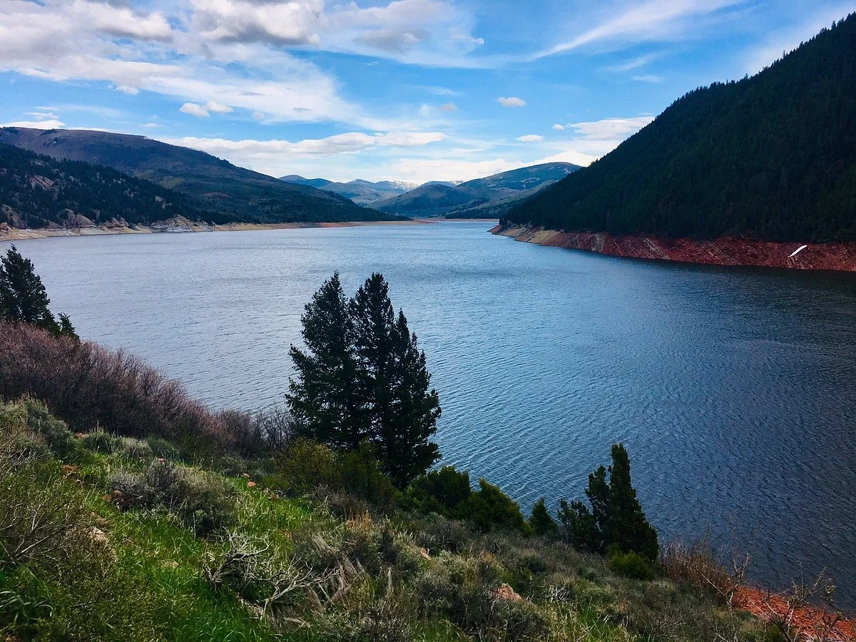
Ruedi Reservoir
Ruedi Reservoir was built in 1968 as part of the Fryingpan–Arkansas Project, to compensate for water diverted from the Fryingpan and Roaring Fork drainages to Colorado's Front Range. The dam stands 285 feet high and 1,042 feet long, impounding 102,000 acre-feet of water across a surface area of 997 acres. It sits at about 7,766 feet, straddling the Pitkin–Eagle county line inside the White River National Forest.
At nearly 1,000 acres, it's big enough for real boating — sailing, motorized boating, fishing, and camping are the main draws, with four Forest Service campgrounds totaling 81 campsites and two boat ramps — reservable through Recreation.gov. Game fish include rainbow, brown, and mackinaw (lake) trout, and the reservoir is also stocked with kokanee salmon.
The reservoir is typically at its lowest in April, rises through spring snowmelt, and is full or nearly full by mid-July most years. If you're coming to paddle or sail, aim for mid-July through September. Facilities close in winter due to ice and snow.
Hiking and the Wilderness Areas
The valley is bracketed by two federally designated wilderness areas, and both are accessible from Frying Pan Road.
Hunter–Fryingpan Wilderness — 82,026 acres, designated by Congress in 1978, holding the headwaters of Hunter Creek and the Fryingpan River plus the peaks of the Williams Mountains. About 65 miles of trail leave from 11 trailheads and climb drainages into the mountains. The Lost Man Trail crosses South Fork Pass and continues down the South Fork of the Fryingpan — roughly 10 miles — providing access to the heart of the area. Sitting between Holy Cross to the north, Maroon Bells–Snowmass to the west, and Collegiate Peaks to the south, Hunter–Fryingpan is the one everybody forgets — which is exactly its appeal. Many opportunities for solitude exist here.
Holy Cross Wilderness — 122,797 acres with 164 miles of trails, established in 1980, forming the valley's northern boundary.
Elevations in Hunter–Fryingpan run from about 9,000 to 13,000 feet. Aspen forests at lower elevations give way to spruce and fir, then to alpine tundra and wildflowers above treeline. Elk, mule deer, and black bear live in these woods.
The valley also provides access to the 10th Mountain Division Hut System — a nonprofit managing 38 backcountry huts linked by 350 miles of routes — including the Betty Bear and Harry Gates huts (browse the full system) — a draw for backcountry skiers and summer hut trippers alike.
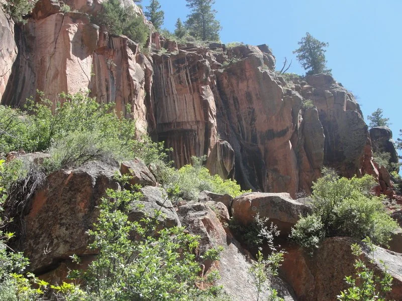
Rock Climbing
The Fryingpan's red sandstone makes for distinctive climbing, and there are three main areas: the Pan Handle, Lime Creek, and Seven Castles. Aspen Expeditions— guiding out of Aspen since 1977 under a Forest Service permit — guides climbing on the valley's classic red rock if you'd rather go with someone who knows it.
Horseback Riding
Old Time Outfitting / D&G Horses is a family-run outfit that's been in the Upper Fryingpan for decades, running trail rides out of a trailhead on Frying Pan Road above Meredith. Rides run roughly one hour to full-day, and they also guide elk and deer hunting camps in the backcountry. Reservations are required, and their riding season is short — book ahead.
Biking
Frying Pan Road is a legitimate road-bike objective — 32 paved miles from Basalt through Meredith, Thomasville, Norrie, and Nast, climbing steadily the whole way with the river beside you. Regulars will tell you the wind is in your face in both directions.
For gravel, the network of old logging roads and high-mountain dirt near Hagerman Pass is the draw.
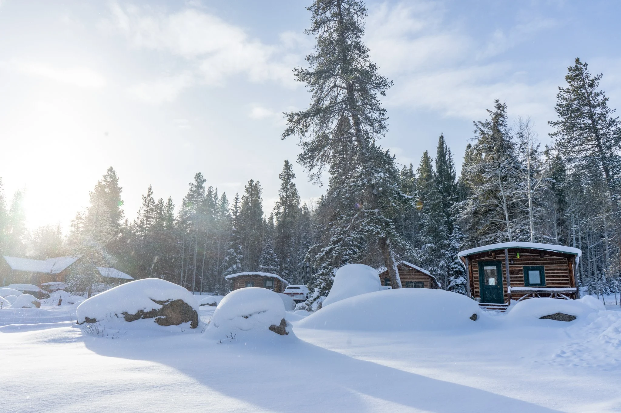
Winter in the Valley
This is where the valley separates itself from the rest of the Aspen area. Frying Pan Road is paved and plowed all winter, so the valley stays accessible — but Hagerman Pass Road closes and Frying Pan Road is plowed to the intersection with Fryingpan Lakes Road at the info kiosk. Beyond that, it becomes a cross-country ski and snowshoe route.
Winter here means backcountry and cross-country skiing, snowshoeing, hut trips, snowmobiling on Hagerman Pass and Lime Creek, and — for the stubborn — some of the best fishing of the year on an empty river. Aspen, Snowmass, Buttermilk, and Highlands are all within about an hour for resort days.
Important: Hagerman Pass itself typically opens in late May, though snow can block it until as late as early July, and it closes with the first heavy snow in mid to late autumn. The Forest Service generally has the dirt section open to vehicles from around May 21 to November 22, but confirm before you plan around it. The pass requires high-clearance 4WD — 2WD vehicles can't make the summit due to rocky terrain and stream crossings.
Practical Planning
Getting there: From Basalt, take Frying Pan Road east. It's paved the whole way to the valley's upper reaches. (Detailed directions →)
Cell service: There isn't any. Not "spotty" — none. Download your directions before you leave Basalt. This is the single most common mistake visitors make.
Groceries: The nearest full grocery stores — Whole Foods and City Market in Willits — are about 50 minutes from the upper valley. There's a small general store in Meredith, open summers only with limited hours. Shop before you drive up.
Winter driving: Frying Pan Road is paved and plowed, but 4WD/AWD with snow or all-season tires is strongly recommended, especially for the unpaved driveways of properties up-valley.
Elevation: The valley floor runs from about 6,600 feet at Basalt to over 8,000 feet at Meredith and Thomasville. Drink more water than you think you need, and give yourself a day before attempting anything strenuous.
Wildlife: Deer, elk, fox, coyote, bighorn sheep, turkeys, eagles, hawks, osprey, owls — and the occasional bear or moose. Keep food, trash, and coolers inside a closed cabin or vehicle.
A Little History
The valley has a longer past than its emptiness suggests. The Colorado Midland Railroad ran through here in the 1880s, over the divide at Hagerman Pass, connecting Colorado Springs and Leadville to Glenwood Springs and Grand Junction. The Denver & Rio Grande and the Colorado Midland raced each other to reach Aspen from Leadville. The historic barn at the entrance to the Diamond J — now Beyul Retreat — was built in 1893 and once served as the railroad's ticket office.
The property at the confluence of the North Fork and the Fryingpan was homesteaded by the Bowles family in 1928. The Rileys came second, building many of the cabins for a guest ranch operation starting in 1941; the peak above the property still carries the name Riley Mountain (10,335 ft).
Where to Stay in the Fryingpan Valley
Lodging up-valley is genuinely limited — which is the point, and also a planning constraint. Book early.
Beyul Retreat sits at mile 26, five minutes past Ruedi Reservoir, on the site of the historic Diamond J guest lodge. It's 32 private acres of meadow, forest, creeks, waterfalls, and ponds at 8,300 feet, with 1,700 feet of Fryingpan River frontage and the White River National Forest wrapping the property on three sides.
There are 13 cabins and 6 lodge rooms + 6 lodge rooms — one Queen Suite with ensuite bath, and five Queen + Twin rooms with hall bath.
On-site: a traditional dry cedar sauna, hot tub, and cold plunge (open 24 hours, quiet hours before 8am and after 9pm); wood-burning stoves and firewood; private trails; large-scale art installations in the forest, including the Forest Spiral; paddleboards, a canoe, and a paddleboat on the pond; snowshoe rentals in winter; and a bodega with provisions and local coffee.
Dogs are welcome in most cabins ($50/night, $100/night for Aspen Lodge and Mountain View). No dogs in the main lodge.
Beyul — pronounced bay-yule — is a Tibetan word meaning "hidden lands": places, in the tradition, where the physical and spiritual worlds meet. Anyone who has driven 26 miles up a road with no cell service and watched the canyon open up will understand why the name fit.
Frequently Asked Questions
How far is the Fryingpan Valley from Aspen? Roughly an hour by car. You'll drive down-valley to Basalt on Highway 82, then head east up Frying Pan Road.
Is there cell service in the Fryingpan Valley? No. Download directions and anything else you need before leaving Basalt. Some properties, including Beyul Retreat, offer satellite wifi and wifi calling — see the FAQ for details.
Can you fish the Fryingpan River year-round? Yes. Because it's a tailwater with stable temperatures roughly between 38 and 52°F, trout feed all twelve months — and winter is often the best time to have the river to yourself. The section from Ruedi Dam to the Roaring Fork is catch-and-release for everything except brown trout, artificial flies and lures only.
Is Frying Pan Road open in winter? The paved section is plowed and open year-round. The dirt section over Hagerman Pass closes for winter; the road is plowed to the Fryingpan Lakes Road intersection.
Do I need 4WD? For the paved road in summer, no. In winter, 4WD/AWD with proper tires is strongly recommended. For Hagerman Pass in summer, high-clearance 4WD is required.
How big is Ruedi Reservoir? 997 acres of surface area, impounding 102,000 acre-feet. It's typically full by mid-July.
What's the closest grocery store? Whole Foods and City Market in Willits, about 50 minutes from the upper valley. Meredith has a small general store, summer only.
