
Hiking

Whether you’re hiking straight from our 32-acre property or the hitting one of the many trails in just a short drive, you’ll enjoy incredible high-country tranquility and scenery.
BEYUL HIKING GUIDE
EASY HIKES ON PROPERTY
T H E A R T I S T ‘ S P A T H W A Y
This beautiful pathway on Beyul Retreat was created by our Artist in Residence, Heather Hansen, and it continues to grow and change! Start by heading down the driveway from the Main Lodge. The path will appear on the left and take you by our waterfall and around the big pond, with different surprises depending on which direction you take! Then follow it behind the old Barn for a creature surprise and more riverfront access before following it back up to the cabins and lodge.
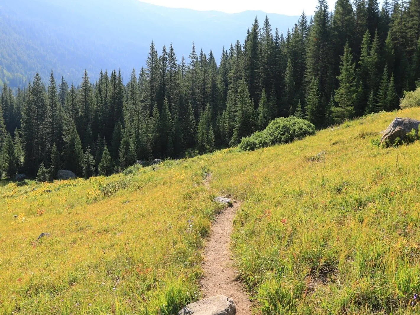
T H E M U C K A W A N A G O C R E E K T R A I L
This twenty-minute loop starts one hundred yards past the Muckawanago Creek (which means “a bear crossing'' in the native Ute language). Walk over the creek, in between Aspen Lodge and Sunset cabin on the east side of the property. Come to an open clearing, and take the path to your right that leads you up the hill. The path is easy to follow, passing over the dry creek bed, slowly gaining elevation. Many medicinal herbs grow along the path, as well as fruit-bearing bushes like Serviceberry, Gooseberry, Currants, and Raspberry. Once you come onto a rise, look for the big boulder. At this point, you can walk to your right to connect with the road that leads back down to the Beyul lodge, or go around the boulder to go uphill a bit farther, then turn back downhill once you join the clear road that leads you downhill back to Beyul!
T H E N O R R I E T R A I L
This lovely flat trail takes you 1.15 miles to the Norrie Colony, a private neighborhood of cabins. Walk over the Muckawanago Creek and follow the road that leads east, between Aspen Lodge and Sunset Cabin. Look for the “Throne Rock'' on your left, and the “Split Rock” also on your left. Continue following the clear trail through alpine meadows with glaciated boulders, and unique tundra flowers. Once at Norrie Colony, follow the dirt road to your right for a longer hike, or turn around and come back the way you came!
NEARBY MEDIUM GRADE HIKES
T H E R I L E Y M O U N T A I N T R A I L
Start right behind the Beyul Lodge and head south, up the hill. Follow the road up as far as you would like. Fifteen minutes up you will find a lovely open meadow. To continue, stay to the right hand side of the creek bed, and continue up the steep trail. Another 30 minutes will bring you to the southside of a ridge with open views of the Muckawanago Drainage. Follow the same path down for a decently strenuous morning or evening hike or run!
T H E C H A P M A N L A K E T R A I L (2.7 miles round trip, 311 ft elevation gain, average 1h)
Follow the Norrie road up the mountain, and instead of turning right to Twin Meadows, turn left towards Chapman Gulch. Another fork will have signs that point left for the South Fork road, and to the right Chapman Gulch. 1-2 miles up, a trail head for Chapman Lake will be on your left. Park there, and climb .5 miles uphill to go to Chapman Lake with its lovely lily pads.
DAY HIKES
(4 Wheel drive cars recommended for drive to trailhead)
S A V A G E L A K E S T R A I L (3.9 miles round trip 1,318 ft elevation gain, average 2h30m)
Turn right (east) onto Frying Pan Road for .5 miles. Take your first left onto the dirt road N Fork Rd/Co Rd 4B (staying right). Follow N Fork Rd for 8 miles. When you reach a fork take a left and follow signs to the Savage Lakes Trailhead (35 minute drive in total). There will be a sign at the trailhead and a parking area to the right. The trail head goes uphill to the left and is marked. You can also extend this hike on to Carter lake or take the informal trails past Savage lake up the hill for spectacular views.
D I E M E R L A K E A N D S E L L A R L A K E (4.2 mi round trip to Sellar, 688 ft elevation gain, average 2h)
Follow the Frying Pan Road uphill to the east until you get to the end of the pavement. Continue up the road to your left towards Hagerman pass. At Sellar meadow, a road turns left and a sign gives mileage to get to Sellar Lake and Diemer lake. With a good vehicle you can drive to both, or start hiking from this point.
L Y L E L A K E A N D M O R M O N L A K E (6.0 miles round trip 1,358 ft elevation gain, average 3h10m)
Follow the Frying Pan Road uphill to the east until you get to the end of the pavement. Continue up the road to your left towards Hagerman pass. Pass Sellar Meadow, and continue on. The trail head goes uphill to the left, at the turnoff that goes up to Hagerman pass. The road to the right leads to Ivanhoe lake.
E A G L E L A K E (6.4 miles round trip 1,046 ft elevation gain, average 2h40m)
Head down valley for one mile, then turn right onto the Eagle-Thomasville road. After 20 minutes you will be in the beautiful Lime Park Meadows. Once you see a sign that points you left towards Eagle/Sylvan Lake/400 road, take a right towards Woods lake and Burnt Mountain. At the next bridge, take a left to Eagle and Woods lake. Woods lake is private, at its entrance a clear sign gives you the trailhead for Eagle lake.
F R Y I N G P A N L A K E S (8.2 miles round trip 1,167 ft elevation gain, average 3h30m)
Follow the Frying Pan Road uphill to the east until you reach the end of the pavement. To your right is the 505 road, follow this to the end. Follow the sign and trail to Frying Pan Lakes. The Trail is gorgeous and takes you through a high mountain valley and dense conifer forests to three pristine alpine lakes. The trip is 8 miles round trip if you go to the third lake. There is one section 2 miles in with significant treefall, but look for the path the forest service has made to get around it.
T W I N M E A D O W S T O S P R U C E C R E E K - N O R R I E (12.4 mi round trip, 3,310ft gain, 7hr)
O R S A W Y E R L A K E T R A I L (7.9 miles out/back, 1,650 ft elevation gain, average 4h)
Drive one mile east to the Norrie Trail, and follow the road up for 10-15 minutes. When the road forks, go right and follow the signs to the Twin Meadows area. Two beautiful lakes give a great picnic spot. Follow the Trail signs for Aspen Norrie Trail to your right. Head south for the Sawyer Lake trail, which is 8 miles round trip but not much elevation gain.
G R A N I T E L A K E S (13.2 miles round trip 3,106 ft elevation gain, average 7h)
Follow the Frying Pan Road uphill to the east for 5 miles, just before the pavement ends. Turn right onto Co Rd 4F towards Nast and follow it for 1.5 miles to the parking space on the right. Walk a few hundred meters past the parking lot along the dirt road until you reach a small collection of buildings. The trail is off to the left and is sign posted. This is a more challenging trail with deadfalls to navigate, and at times it can be hard to see the trail. We recommend downloading the alltrails map to help you navigate. Give yourself time to enjoy the two lakes at the end before