
Gravel Biking
Positioned at a nexus of over a dozen gravel Forest Service roads that lead to jaw-dropping views of the Holy Cross & Maroon Bells Wildernesses, Beyul is a sweet spot for gravel biking aficionados. You can depart from all of these right from Beyul with minimal road riding, and the out-and-back routes provide options for both an epic grind or leisurely day tours.
BYO Bike. Flying in? Stop on your way into Beyul at Basalt Bike & Ski for rental options - once you get here it’s a long drive back to town.
Arriving By Bike? Coming in car-free for your overnight stay from Eagle, Aspen, Leadville, or elsewhere on your bike, with all your gear on your bike? Let us know for a 15% crusher discount.
Gravel Biking Routes
Eagle-Thomasville Road
44 miles round trip out and back
2000’ of Climbing
View on Google Maps

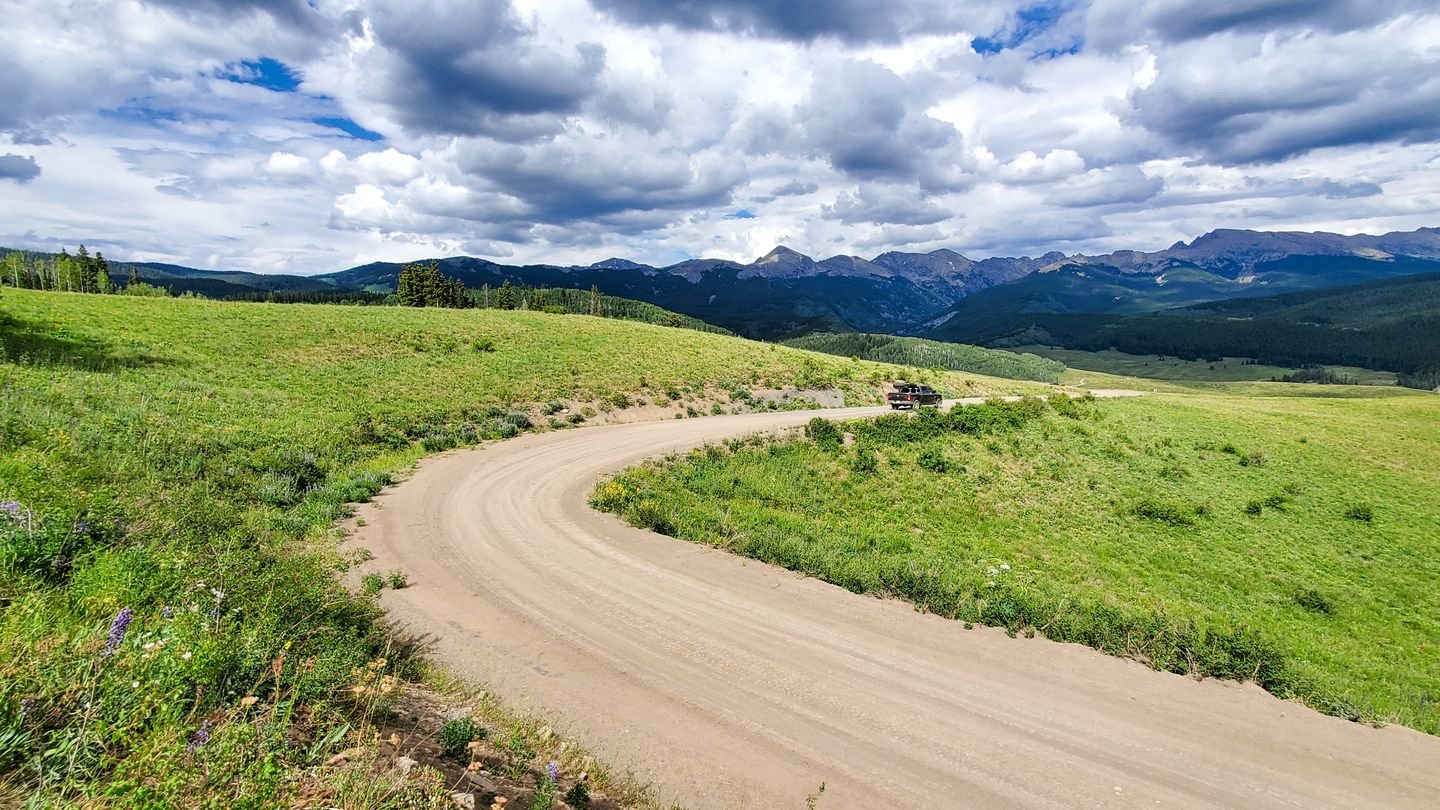
This well-maintained gravel road leads from Beyul up through a huge swath of mountain wilderness over to the Eagle/Vail area. It takes you through rolling alpine meadows with unbelievably spectacular views of the Holy Cross Wilderness, and past Lime Park, a beautiful canyon that is a rock climbing destination. There is no need to bike the whole 44 miles unless you want to go Eagle — the high point is about ___ miles in.
From Beyul: 1 mile back down the paved Frying Pan Road and then take a right to begin your glorious journey up the Eagle-Thomasville route.
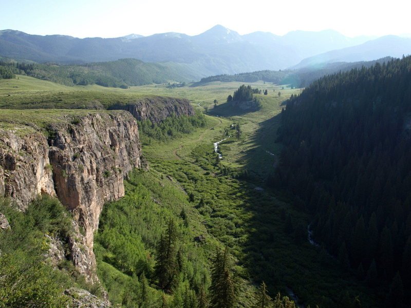
Lime Park off Eagle-Thomasville Road - Photo Credit: Mountain Project

From Beyul: Head right out of Beyul and take your first left onto N Fork Rd. After 3 miles turn left onto Burnt Mountain Rd. After 13 miles turn left onto Brush Creek Rd/ Eagle-Thomasville Rd until it connects back to Frying Pan Rd.
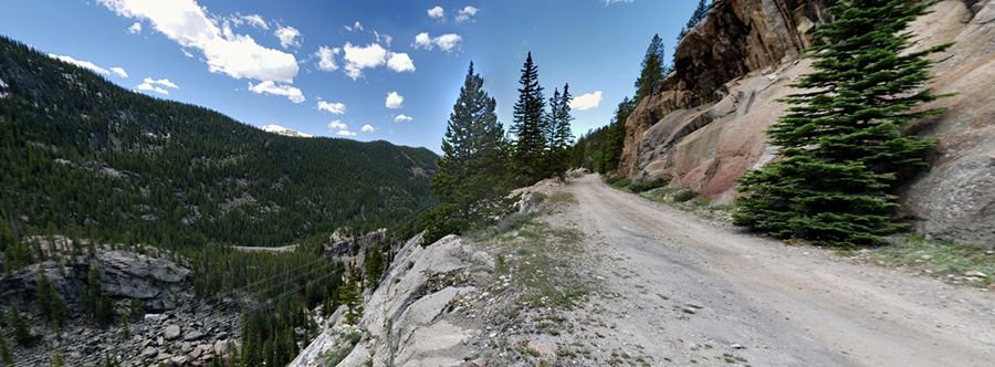

This route, technically FR 504, starts with switchbacks taking you up and out of the river valley with teasers of the beautiful views to come. Travel through evergreen and aspen forest to reach the turnoff for Twin Meadows, a little spur worth the side-trip for the lovely scenery. Back on the main gravel road you’ll dip down and cross Chapman Gulch before coming to an intersection, turn left. A bit more descent and you’ll be in the scenic canyon of the South Fork of the Frying Pan, which you can explore several miles up until the road ends at a gauging station.
From Beyul: Head 1.5 miles further up the paved Frying Pan Road to Norrie Colony and take a right.

From Beyul: Head 6 miles further up the Frying Pan Road to where the pavement ends. Take a hard right across the river on forest road 505 (marked on some maps as a hiking trail). Continue for 6 miles up to the gauging station.
Hagerman Routes
Route 1: Wildcat Mountain Loop
Miles: 40
Elevation Gain: 3,700ft
GPX File
Description: Leaving from Beyul, this ride begins with a few miles on pavement before turning off on the old railroad grade. You can skip the road warm-up by driving to the gravel turn off where the lollipop diverges into a loop It then winds up to and around Ivanhoe lake. Once you're past the water diversion on the east end of the lake, the road is no longer maintained by the power company and it will get a little rockier, but it's still an old railroad grade, so the incline is minimal. It eventually turns right on to a USFS road as the railroad enters an abandoned tunnel a few miles up which isn't passable. The route then begins to descend a 4x4 road that is a little loose and rocky at times. You will pass the access to the 10th Mtn Division Betty Bear Hut, after which there is a short single track descent that isn't well maintained. Hardtail riders will be fine, but drop bar bikes might need to walk some sections. The single track puts you out by another road maintained by the power company which is a smooth gravel ride back. I would recommend a hardtail with smooth rolling tires or a dropbar with +35mm tires, anything less might make for a long day unless you’re a confident bike handler. I would also highly recommend doing the loop clockwise and not counterclockwise or you will likely have a decent amount of walking.

Photo Credit: Reddit
Route 2: Hagerman Powerline Loop
Miles: 30
Elevation Gain: 3,100ft
Strava link: https://www.strava.com/activities/7606111905
(GPX file )
Description: This ride starts from Beyul, but turns off on to gravel road within the first half mile and passes Elk Wallow Campground. The road is very well maintained until you pass a series of water diversions, after which the road becomes a little rougher but is still very readable on a gravel bike. After a series of switchbacks you'll reach the top of a small pass with power lines overhead. Note that the following descent can be washed out and generally has some large "babyheads" or rocks that can put you down if you get going too fast. After descending through an open field under power lines, you will take a right on an old railroad grade that will bring you back to payment and eventually Beyul. This railroad descent is the same previous route climbed and these two loops can be combined.
Route 3: Crooked Creek Figure 8
Miles: 58
Elevation Gain: 7,627ft
Strava Link: https://www.strava.com/activities/7612217532
GPX file
Route 3: This route heads north towards the Eagle/Vail area instead of east in high rockies like the previous two routes. These lower elevation roads are considerably more smooth and perfect for a dropbar gravel bike with anything over 35mm tires. There is a considerable amount of elevation gain on the ride but all the climbs are at a reasonable grade. I would recommend doing both loops counterclockwise. If you wanted to shorten the loops you can drive up and skip the first loop. This is a beautiful Colorado gravel ride with no single track and not more than a mile of pavement involved.
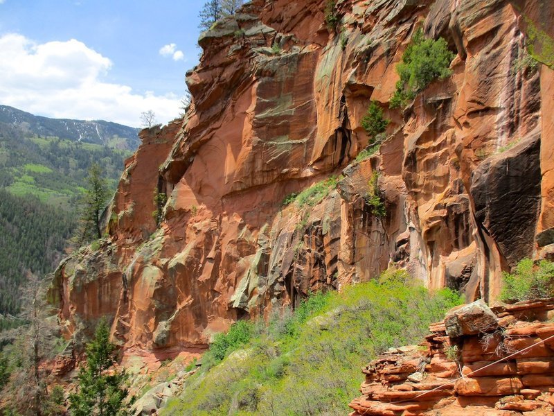
Photo Credit: Mountain Project